


University of Hawai'i Press
Article

Topographic History of the Maui Nui Complex, Hawai'i, and Its Implications for Biogeography1
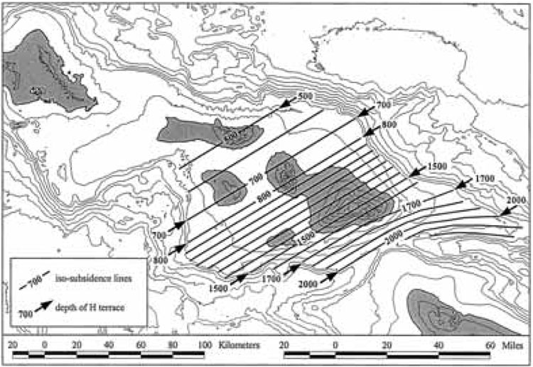
Figure 6.
Estimated subsidence since 1.2 Ma. Contour interval is 500 m. Arrows show depth of H terrace at select locations. Solid lines indicate assumed amount of subsidence since the formation of the H terrace (iso-subsidence lines). For the Haleakalā ridge east of Maui, the direction and degree of tilt was determined from examination of submerged coral reefs that were originally horizontal (Moore et al. 1992).
